
-
![Porto Conte Bay to Platamona walking map [6]](//climb-europe.com/cdn/shop/files/06-porto-conte-bay-to-platamona-walking-map.jpg?v=1749647692&width=370 370w)
Sports & Hobbies
Porto Conte Bay to Platamona walking map [6]
This Dalla Baia di Porto Conte a Platamona walking map covers many walking, hiking and cycling paths and trails along the northern western part of Sardinia...
Regular price £8.95 GBPSale price £8.95 GBP Regular priceUnit price perSale Sold out -
![Prespa, Vitsi, Voras Walking Map [6.2]](//climb-europe.com/cdn/shop/files/prespa-vitsi-voras-walking-map-2024.jpg?v=1749646136&width=370 370w)
Sports & Hobbies
Prespa, Vitsi, Voras Walking Map [6.2]
This is a double sided walking map at a scale of 1:50,000. The one side of the map covers the Prespa National Park that including Mt...
Regular price £8.95 GBPSale price £8.95 GBP Regular priceUnit price perSale Sold out -
![Samaria Gorge, Sougia, and Paliochora Walking Map [11.13]](//climb-europe.com/cdn/shop/files/samaria-gorge-sougia-paliochora-walking-map-2023-11-13.jpg?v=1749647784&width=370 370w)
Sports & Hobbies
Samaria Gorge, Sougia, and Paliochora Walking Map [11.13]
This map shows all the walking and hiking paths around the towns of Sougia, and Paliochora in southeast Crete, at a scale of 1:30,000. The map...
Regular price £8.95 GBPSale price £8.95 GBP Regular priceUnit price perSale Sold out -
![Santa Catherine of Pittinuri to Capo Caccia walking map [5]](//climb-europe.com/cdn/shop/files/05-santa-catherine-of-pittinuri-to-capo-caccia-walking-map.jpg?v=1749647693&width=370 370w)
Sports & Hobbies
Santa Catherine of Pittinuri to Capo Caccia walking map [5]
This Da Santa Catherine di Pittinuri a Capo Caccia walking map covers many walking, hiking and cycling paths and trails along the western coastal region from...
Regular price £8.95 GBPSale price £8.95 GBP Regular priceUnit price perSale Sold out -
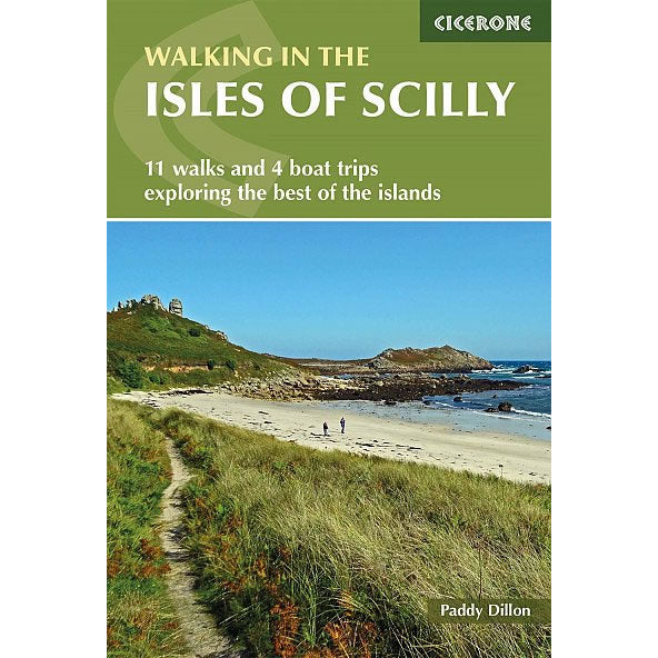
Sports & Hobbies
Walking in the Isles of Scilly Guidebook
This Cicerone walking Guidebook describes 11 easy walks and 4 boat trips on the Scilly Isles, an Area of Outstanding National Beauty (AONB). The walks are...
Regular price £8.95 GBPSale price £8.95 GBP Regular priceUnit price perSale Sold out -
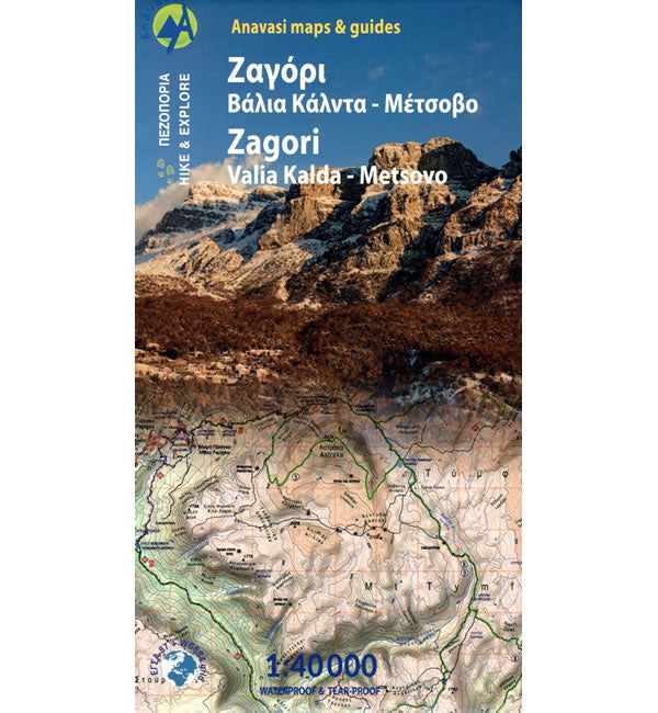
Sports & Hobbies
Zagori and Valia Kalda Walking Map
This walking map covers Zagori and Valia Kalda in the North Pindus (Pindos) Mountains, at a scale of 1:40,000 detailing many walking and hiking paths. One...
Regular price £8.95 GBPSale price £8.95 GBP Regular priceUnit price perSale Sold out -
![Zakros, Vai, and Sitia Walking Map [11.16]](//climb-europe.com/cdn/shop/files/crete-zakros-vai-sitia-walking-map-11-16.jpg?v=1749647781&width=370 370w)
Sports & Hobbies
Zakros, Vai, and Sitia Walking Map [11.16]
This map shows all the waking paths and hiking trails on the eastern edge of Crete, at a scale of 1:25,000. It covers the area around...
Regular price £8.95 GBPSale price £8.95 GBP Regular priceUnit price perSale Sold out -
![Mount Ziria Hiking Map [8.31]](//climb-europe.com/cdn/shop/files/mount-ziria-hiking-map.jpg?v=1749645943&width=370 370w)
Sports & Hobbies
Mount Ziria Hiking Map [8.31]
This Mount Ziria (Kyllini) map covers the region around the mountain from Trikala in the north to the wild ranges of Mount Oligirtos in the south,...
Regular price £8.95 GBPSale price £8.95 GBP Regular priceUnit price perSale Sold out -
![Paklenica National Park Walking and Trekking Map [18] - Published by CMRR](//climb-europe.com/cdn/shop/files/Paklenica-National-Park-Map-18.jpg?v=1773242008&width=370 370w)
Sports & Hobbies
Paklenica National Park Walking and Trekking Map [18]
This map covers the walking, trekking and cycling trails in the Paklenica National Park near Starigrad-Paklenica in the southern Velebit Mountains at a scale of 1:25,000. ...
Regular price £8.95 GBPSale price £8.95 GBP Regular priceUnit price perSale Sold out -
![Biokovo Mountain Nature Park Walking and trekking Map [6] - Published by CMRR](//climb-europe.com/cdn/shop/files/Biokovo-Mountain-Nature-Park-Walking-and-trekking-Map-6.jpg?v=1773244416&width=370 370w)
Sports & Hobbies
Biokovo Mountain Nature Park Walking and trekking Map [6]
This map covers the walking, trekking and cycling trails in the Biokovo Mountain Nature Park near the town of Makarska. At a scale of 1:25,000, the...
Regular price £8.95 GBPSale price £8.95 GBP Regular priceUnit price perSale Sold out -
![Sjeverni Velebit National Park Walking and Trekking Map [36]](//climb-europe.com/cdn/shop/files/Sjeverni-Velebit-National-Park-Walking-and-Trekking-Map-36.jpg?v=1773340366&width=370 370w)
Sports & Hobbies
Sjeverni Velebit National Park Walking and Trekking Map [36]
This map covers the walking, trekking and cycling trails in the Sjeverni Velebit National Park that includes many peaks over 1,600m high at a scale of...
Regular price £8.95 GBPSale price £8.95 GBP Regular priceUnit price perSale Sold out -
![Dinara (Sinjal) Mountain Nature Park Map [24]](//climb-europe.com/cdn/shop/files/Dinara-Mountain-Nature-Park-Walking-and-trekking-Map-24_e3c2b6ed-aa40-4aca-a513-8bf336ac5781.jpg?v=1773409674&width=370 370w)
Sports & Hobbies
Dinara (Sinjal) Mountain Nature Park Map [24]
This map covers the walking, trekking and cycling trails around Dinara (Sinjal) Mountain, which is Croatia’s highest mountain at 1,831m high at a scale of 1:25,000. ...
Regular price £8.95 GBPSale price £8.95 GBP Regular priceUnit price perSale Sold out -
![Plitvice Lakes National Park Walking Map [15]](//climb-europe.com/cdn/shop/files/Plitvice-Lakes-National-Park-Map-15.jpg?v=1773587891&width=370 370w)
Sports & Hobbies
Plitvice Lakes National Park Walking Map [15]
This map covers the walking and trekking trails around Plitvice Lakes National Park (Nacionalni Park Plitvička Jezera). The map includes information (English and Croatian text) about...
Regular price £8.95 GBPSale price £8.95 GBP Regular priceUnit price perSale Sold out -
![Rab Island Walking and Trekking Map [17]](//climb-europe.com/cdn/shop/files/Rab-Island-Walking-and-Trekking-Map-17.jpg?v=1773667804&width=370 370w)
Sports & Hobbies
Rab Island Walking and Trekking Map [17]
This map covers the walking, trekking and cycling trails on Rab Island at a scale of 1:25,000. Rab is a popular walking and hiking destination and...
Regular price £8.95 GBPSale price £8.95 GBP Regular priceUnit price perSale Sold out -
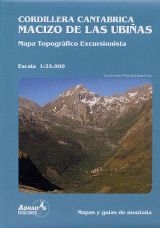
Sports & Hobbies
Cordillera Cantabrica - Ubinas Massif Map
This is a map of the Ubinas massif mountain in the Cantabrian Mountains in northern Spain. The Ubinas Mountains are located to the south of Oviedo...
Regular price £8.99 GBPSale price £8.99 GBP Regular priceUnit price perSale Sold out -
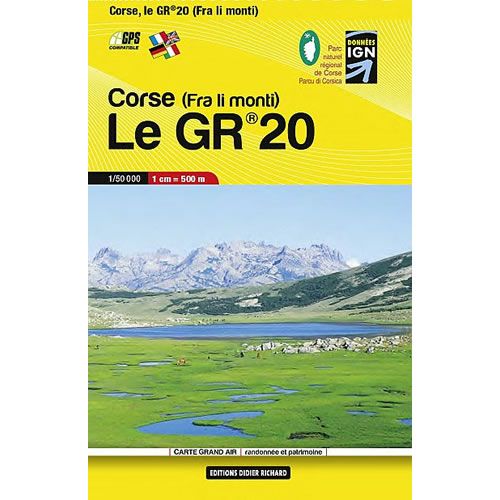
Sports & Hobbies
Corsica GR20 Trail Pocket Map
This Corse le GR20 trail map shows the entire GR20 on one pocket sized light weight map. GR hiking trails are all highlighted plus the road...
Regular price £8.99 GBPSale price £8.99 GBP Regular priceUnit price perSale Sold out -
Sports & Hobbies
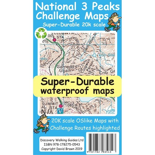
National 3 Peaks Challenge Map
This National 3 Peaks Challenge Map shows an individual map for routes up challenge peaks of Ben Nevis, Scafell Pike and Snowdon. The Ben Nevis map...
Regular price £8.99 GBPSale price £8.99 GBP Regular priceUnit price perSale Sold out -
Sports & Hobbies
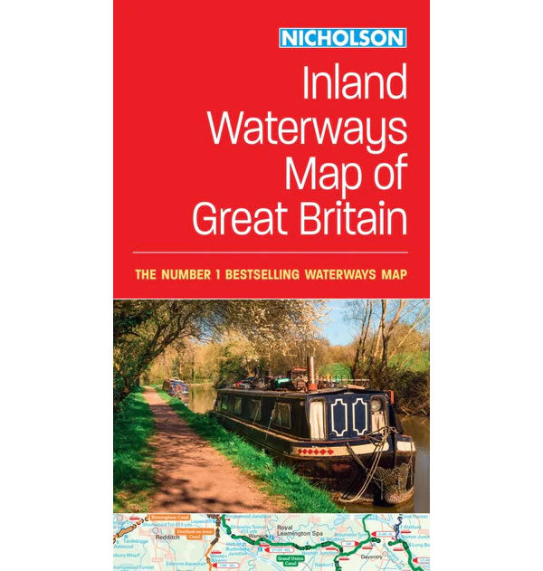
Nicholson Inland Waterways Map of Great Britain
A comprehensive cruise-planning map of Britain's inland waterways.This Nicholson Inland Waterways Map of Great Britain covers the entire network of canal and river navigations in England,...
Regular price £8.99 GBPSale price £8.99 GBP Regular priceUnit price perSale Sold out -
Sports & Hobbies
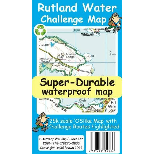
Rutland Water Challenge Map and Guide
Rutland Water is the UK's largest man-made lake set in 4,200 acres of parkland, providing a nice mixture of woodlands and open terrain to explore. The...
Regular price £8.99 GBPSale price £8.99 GBP Regular priceUnit price perSale Sold out -
Sports & Hobbies
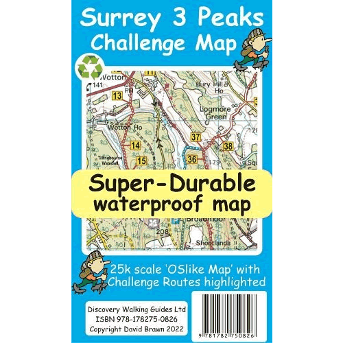
Surrey 3 Peaks Challenge Map and Guide
The Surrey 3 Peaks Challenge takes in the 3 classic Surrey hills of Box Hill, Holmbury Hill, and county-top Leith Hill to provide a circular 22...
Regular price £8.99 GBPSale price £8.99 GBP Regular priceUnit price perSale Sold out -
Sports & Hobbies
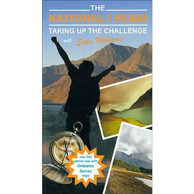
The National 3 Peaks Guidebook - Taking Up The Challenge
This guidebook for the National 3 Peaks Challenge not only describes walking routes up Ben Nevis, Scafell Pike and Snowdon, but also provides plenty of information...
Regular price £8.99 GBPSale price £8.99 GBP Regular priceUnit price perSale Sold out -
Sports & Hobbies
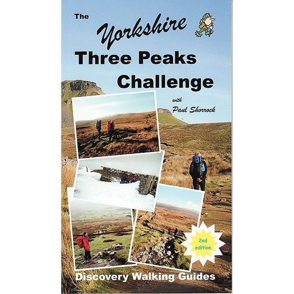
The Yorkshire Three Peaks Challenge Guidebook
This is the ultimate guidebook for preparing and completing the Yorkshire Three Peaks challenge. That is to complete the 3 peaks of Pen y Ghent, Whernside...
Regular price £8.99 GBPSale price £8.99 GBP Regular priceUnit price perSale Sold out -
Sports & Hobbies
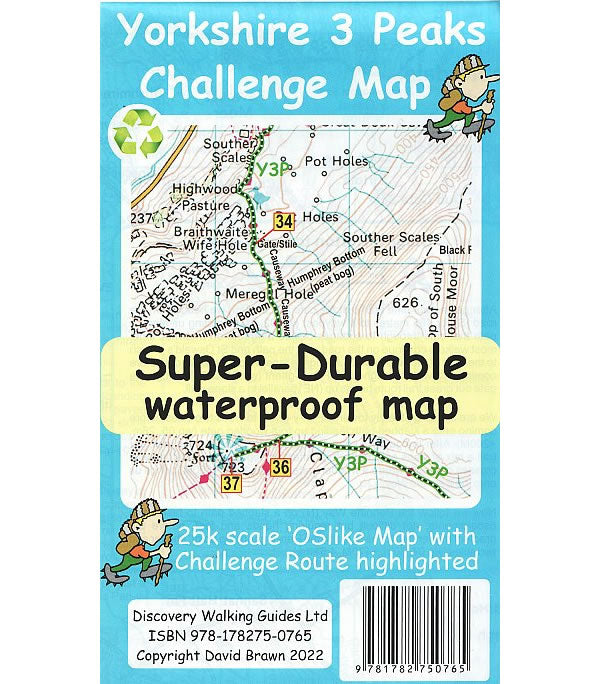
Yorkshire 3 Peaks Challenge Map
This Yorkshire 3 Peaks Challenge Map, at a scale of 1:25,000, shows the full Y3P Challenge Route of completing the 3 peaks of Pen y Ghent,...
Regular price £8.99 GBPSale price £8.99 GBP Regular priceUnit price perSale Sold out -
Sports & Hobbies
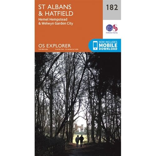
OS Explorer Map 182 - St Albans and Hatfield - slightly damaged
Only 1 copy available at this special low price due to creased front cover - over 25% discount This OS Explorer 182 Map covers St Albans...
Regular price £9.00 GBPSale price £9.00 GBP Regular priceUnit price per£12.99 GBPSale Sold out
![Porto Conte Bay to Platamona walking map [6]](http://climb-europe.com/cdn/shop/files/06-porto-conte-bay-to-platamona-walking-map.jpg?v=1749647692&width=370 370w)
![Prespa, Vitsi, Voras Walking Map [6.2]](http://climb-europe.com/cdn/shop/files/prespa-vitsi-voras-walking-map-2024.jpg?v=1749646136&width=370 370w)
![Samaria Gorge, Sougia, and Paliochora Walking Map [11.13]](http://climb-europe.com/cdn/shop/files/samaria-gorge-sougia-paliochora-walking-map-2023-11-13.jpg?v=1749647784&width=370 370w)
![Santa Catherine of Pittinuri to Capo Caccia walking map [5]](http://climb-europe.com/cdn/shop/files/05-santa-catherine-of-pittinuri-to-capo-caccia-walking-map.jpg?v=1749647693&width=370 370w)


![Zakros, Vai, and Sitia Walking Map [11.16]](http://climb-europe.com/cdn/shop/files/crete-zakros-vai-sitia-walking-map-11-16.jpg?v=1749647781&width=370 370w)
![Mount Ziria Hiking Map [8.31]](http://climb-europe.com/cdn/shop/files/mount-ziria-hiking-map.jpg?v=1749645943&width=370 370w)
![Paklenica National Park Walking and Trekking Map [18] - Published by CMRR](http://climb-europe.com/cdn/shop/files/Paklenica-National-Park-Map-18.jpg?v=1773242008&width=370 370w)
![Biokovo Mountain Nature Park Walking and trekking Map [6] - Published by CMRR](http://climb-europe.com/cdn/shop/files/Biokovo-Mountain-Nature-Park-Walking-and-trekking-Map-6.jpg?v=1773244416&width=370 370w)
![Sjeverni Velebit National Park Walking and Trekking Map [36]](http://climb-europe.com/cdn/shop/files/Sjeverni-Velebit-National-Park-Walking-and-Trekking-Map-36.jpg?v=1773340366&width=370 370w)
![Dinara (Sinjal) Mountain Nature Park Map [24]](http://climb-europe.com/cdn/shop/files/Dinara-Mountain-Nature-Park-Walking-and-trekking-Map-24_e3c2b6ed-aa40-4aca-a513-8bf336ac5781.jpg?v=1773409674&width=370 370w)
![Plitvice Lakes National Park Walking Map [15]](http://climb-europe.com/cdn/shop/files/Plitvice-Lakes-National-Park-Map-15.jpg?v=1773587891&width=370 370w)
![Rab Island Walking and Trekking Map [17]](http://climb-europe.com/cdn/shop/files/Rab-Island-Walking-and-Trekking-Map-17.jpg?v=1773667804&width=370 370w)


