Gramos, Smolikas, Voio, Vasilitsa Walking Map
This is a walking map for the northern part of the Pindus National Park covering the mountains of Gramos, Smolikas, Voio, and Vasilitsa, and the peak of Tsuka Petsik at an altitude of 2,520m (the 4th highest peak in Greece). This mountainous landscape provides numerous peaks and ridges in a remote area of northern Greece. Mt Vasilitsa is also a well-known ski resort.
This map shows part of the E6 long distance path, as well as many other walking and hiking trails at a scale of 1:40,000. It also includes 12 suggested hiking trails on Mount Gramos that range from 8.5km long to 33km long.
Published in 2023 by Anavasi and is map number 3.3. The text and legend of this map is in English and Greek throughout. This Gramos, Smolikas, Voio, Vasilitsa map is laminated (waterproof and rip-proof) and is compatible with GPS systems.
Map Scale is 1:40,000.
ISBN is 9789608195929.
Folded size is 130mm x 245mm.
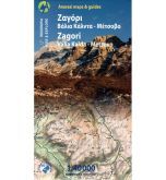
Other walking maps from Anavasi covering the Pindus Mountains include the Zagori and Valia Kalda walking map

![Prespa, Vitsi, Voras Walking Map [6.2]](https://climb-europe.com/pub/media/catalog/product/cache/dadd9a99528695eab1f8fe8a8f1ff559/p/r/prespa-vitsi-voras-walking-map.jpg)