
The Mount Olympus classic ascents and hikes guidebook describes 18 classic routes throughout Mount Olympus National Park and has contact information for all the refuges.
The Olympus classic ascents and hikes guidebook is available from our shop.
Walking and hiking around Mount Olympus National Park
Mount Olympus (Olympos) is one of Greece’s popular and well-known walking destinations as it is the highest mountain in Greece. Its highest peak is called Mytikas (2,918m high) and is located only 90km from Thessaloniki, Greece’s second city, and 420km north of Athens.
Mount Olympus has an extensive network of trails and paths that include classic routes to its highest peaks as well as plenty of other trails that cover the lower slopes through lots of forests. In total there are over 200km of trails, including the European Trail E4 that runs through Mount Olympus in an east-west direction, and the Greek National O2 trail which runs north to south.
For many visitors and hikers the aim is to ascend the top of Mytikas peak. The classic route to this peak starts at Litohoro, passes Prionia (option to park here) and the Spilios Agapitos refuge, and onto Mytikas. The second most popular ascent starts at Diastavrosi passes Petrostrouga and the Giosos Apostolidis refuge, and onto Mytikas. The paths on both of these routes are well trodden and marked with lots of people. In contrast, on paths which do not lead to there you will find fewer or no people at all. The vast majority of trails and paths are marked in a makeshift way with red paint, ribbons on tree branches, various improvised signs, or piles of rocks stacked on top of each other (cairns). Generally the markings on the paths are in good condition, but since there are no standard markings you need to pay attention at junctions.
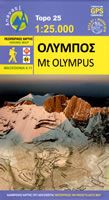
Map of Mount Olympus National Park

Mount Olympus hiking logistics
The Olympus classic ascents and hikes guidebook describes 18 classic routes throughout Mount Olympus National Park plus 5 ski touring routes. This guidebook details over 235km of trails plus lots of additional information about the mountain including contact information for the various refuges. A detailed hiking map at a scale of 1:25,000, simply called Mt Olympus walking map, is also available that covers the area.

The photograph shows the most characteristic section of Mount Olympus. These are its high peaks (Skolio at 2,905m, Mytikas at 2,918m and Stefani at 2,909m) that form a crest, packed with jagged and steep nose-like structures.
The Mount Olympus classic ascents and hikes guidebook describes 18 classic routes throughout Mount Olympus National Park and has contact information for all the refuges.
The Olympus classic ascents and hikes guidebook is available from our shop.